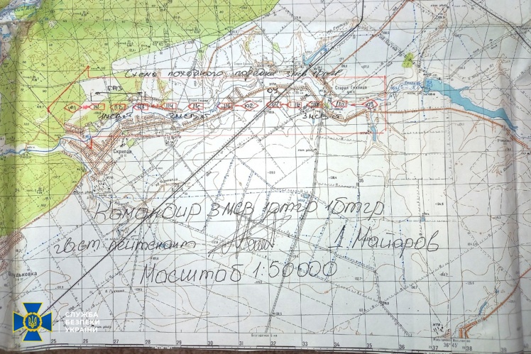
Some of the Russian commanders who invaded Ukraine in February were guided by topographical maps of Ukraine from 1969. Documents were seized from Russians in the occupied districts of the Kharkiv oblast.
The Security Service of Ukraine (SSU) informed about this on July 18 and published the relevant photos.
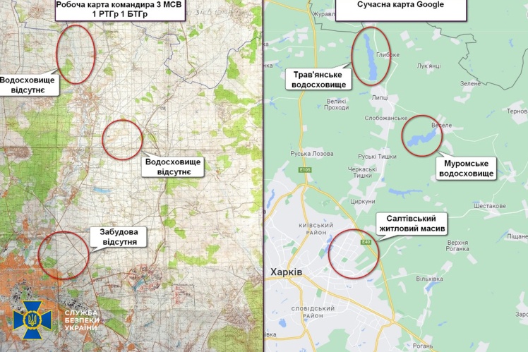
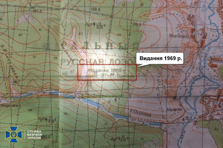
In particular, the information in the documents of the Russian Motorized Rifle Battalion 138 of the Guards Motorized Rifle Brigade was not updated for at least 53 years. For example, on the maps of the occupiers, the Saltivka residential area of Kharkiv, which was built up since the beginning of the 70s of the last century, is completely absent. The Travyansk and Murom reservoirs, built in the 1970s, are also missing. And the state border between Ukraine and Russia is drawn with a ballpoint pen, since it was not on the maps at all. The maps themselves say they were made in 1969.
The SSU writes that the topographical service of the Western Military District of the Russian Federation, headed by Colonel Oleksiy Krasnov, and the Center for Geospatial Information and Navigation of the Russian Federation were engaged in the navigation of this already destroyed battalion. Before the invasion, they announced at the celebration that they were providing the Russian military command with "the most modern maps" made with the help of "the latest mobile navigation and geodetic complexes."
At the same time, the 138th Guards Motorized Rifle Brigade of the Russian Federation, which used these maps, was destroyed at the end of March near the Kharkiv ring road in the direction of Staryi Saltiv.